Maps

the World of Mutania

Mutania World Map

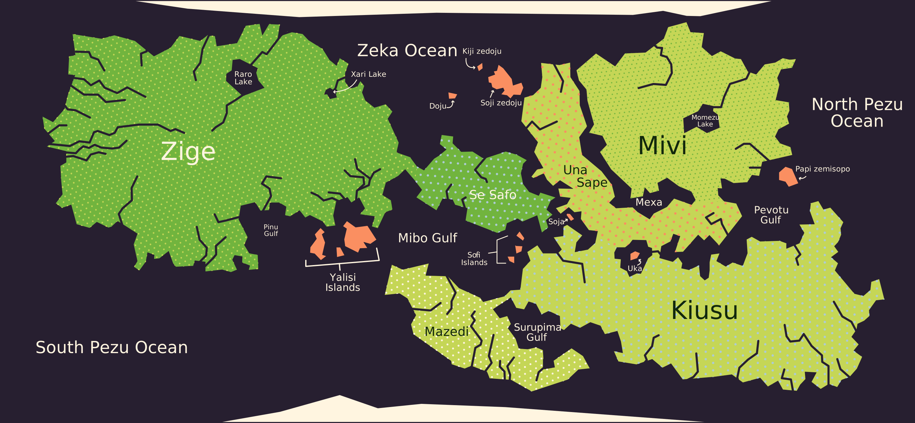
Mutania world map Interactive world map with labeled regions Zige Se Safo Yalisi Islands Doju Islands Mivi Una Sape Kiusu Mazedi Soja Uka Papi zemisopo Sofi Islands

The world of Mutania is divided into two contiguous landmasses. The landmasses are easily crossed between narrow straits near what the Yalisi people call Se Safo. All four species of sophonts can be found across the entire world, although they're not evenly distributed.
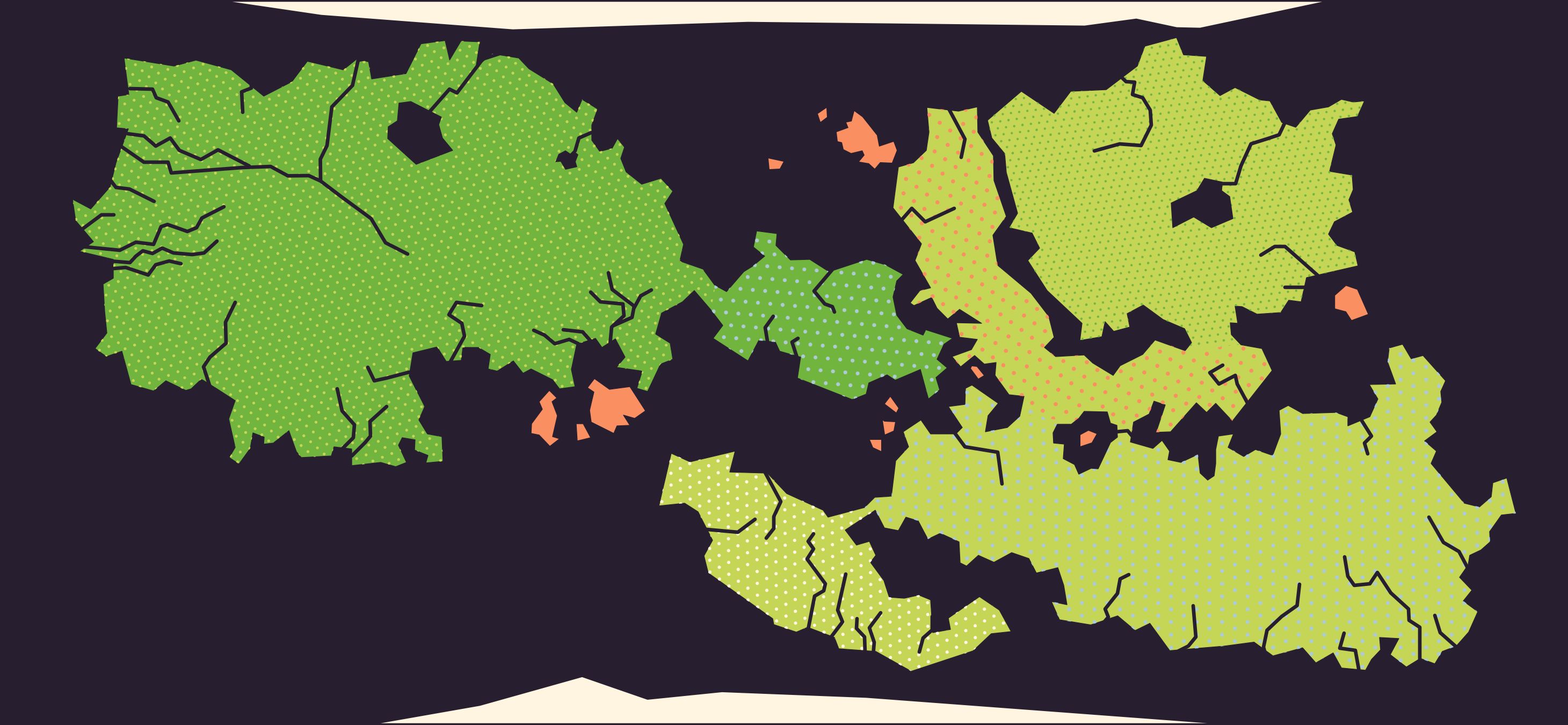
Open the full-size map

Open the full-size map with labels

Yalisi Empire

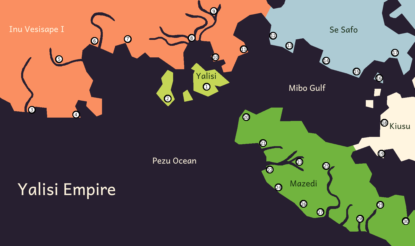
map of the yalisi empire which centers around three large islands in the middle of the pezu ocean, there is a region in the north, the southern part of a large continent, a small landmass to the east that makes up the se safo region, another landmass to the east that makes up the edge of the kiusu region, and a large peninsula connected to kiusu called mazedi

The interactive version of this map can be found here on World Anvil.

Cities

Greater Yalisi

  1. Yalisi
  2. Levegi's Palace

Inu Vesisapi I

  1. Votusuda
  2. Ironuro
  3. Mexanoxe
  4. Lotebo
  5. Sijepaxede
  6. Sipusu
  7. Elonuro
  8. Mojumibo
  9. Nuromiboudi

Se Safo

  1. Nitenuro
  2. Senisuda
  3. Xibo
  4. Veraau
  5. Vamozu on Sofi Moju
  6. Zediduvanuro

Kiusu

  1. Lubovabi
  2. Milifi

Mazedi

  1. Logisuda
  2. Ivanu
  3. Pesaru
  4. Vasaru
  5. Sezamexa
  6. Vaexpoxigu
  7. Supobisuda
  8. Zijipi
  9. Lepavotu
  10. Zevati
  11. Utiutu